

Map Tools - area, distance, radius and angle measurement app for iPhone and iPad
Developer: Natalia Gavrylova
First release : 30 Jan 2015
App size: 11.31 Mb
With this app you can measure routes, property areas, distance to objects, angles between buildings on th map
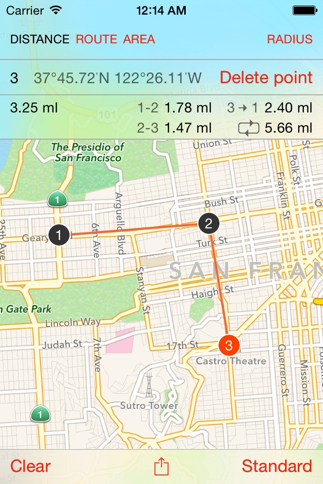
Measure distance: Auto,km,m,cm,nm,ml,ft,yard,rod,inch
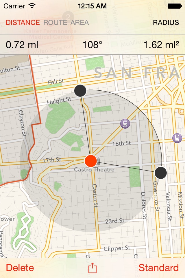
Measure radius: Auto,km,m,cm,nm,ml,ft,yard,rod,inch
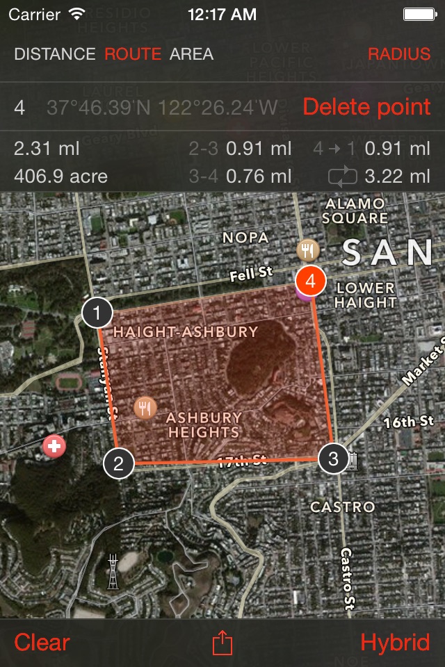
Measure area: Auto,km²,ha,a,m²,cm²,ml²,acre,rood,rod²,yard²,ft²,inch²
Measure angles: degrees
Features:
[+] Universal app for iPhone and iPad
[+] Modern design
[+] Distance measurements
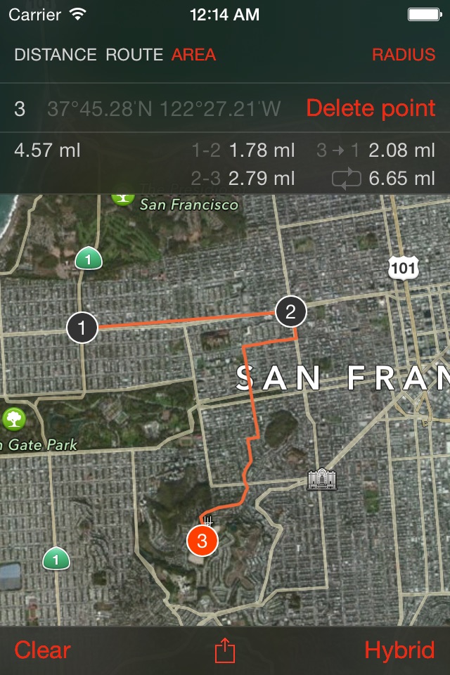
[+] Route measurements
[+] Area measurements
[+] Radius measurements
[+] Angle measurement
[+] Standard/Satellite/Hybrid maps
[+] Your location detected by GPS
[+] Landscape and portrait modes
We appreciate your input. Please help us make this application better – visit our website to see more screenshots and videos and let us know what new features you would like to see.
www.LifewareSolutions.com
If you like the app, please write a review in iTunes. Your support would greatly help!
Latest reviews of Map Tools - area, distance, radius and angle measurement app for iPhone and iPad
Cant even use current GPS location to create waypoints. The menu is confusing and its very difficult to read the distances between points. This app needs to be completely redesigned before I consider it worthy of download.
The app store needs more of this sort of thing. The tools allow you to do some simple technical analysis of maps or imagery. Seems like a simple task but there isnt much out there. I like it - it provides capability that is otherwise missing from my phone. I would make the following recommendations for the developer: 1) give us a way to contact you through email in the app so this sort of stuff doesnt get put here in reviews 2) when exporting to SMS, the measurements between points arent always populated correctly (a simple four point path had the distance between points two and three as "2 - 3" instead of the actual distance like for the other points) 3) allow multiple radius things at a time. right now it deletes the active one when you touch anywhere else (to make a second one) 4) allow multiple independent paths / areas to be displayed 5) allow saving of paths / radii and grouping of overlays into multi overlay views 6) allow customization of paths and radii (color, opacity, display text on map or not...) 7) make it easier to determine what is on and off (distance, route, area... maybe green text is on and red is off) 8) separate circle tool from just angle tool - maybe just the triangles are needed for some applications where the circle distance tool would be better for others 9) continue development! this is good stuff and is a vastly under-served area of the store. Please keep improving.